


Voting District 0500044, Suffolk County, New York
About
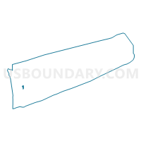
Outline

Summary
| Unique Area Identifier | 636933 |
| Name | Voting District 0500044 |
| County | Suffolk County |
| State | New York |
| Area (square miles) | 1.10 |
| Land Area (square miles) | 1.10 |
| Water Area (square miles) | 0.00 |
| % of Land Area | 100.00 |
| % of Water Area | 0.00 |
| Latitude of the Internal Point | 40.75877410 |
| Longtitude of the Internal Point | -73.28556690 |
Maps


Graphs
Select a template below for downloading or customizing gragh for Voting District 0500044, Suffolk County, New York


Neighbors
Neighoring Voting District (by Name) Neighboring Voting District on the Map
- Voting District 0100097, Suffolk County, NY
- Voting District 0100148, Suffolk County, NY
- Voting District 0500063, Suffolk County, NY
- Voting District 0500069 0500103, Suffolk County, NY
- Voting District 0500080, Suffolk County, NY
- Voting District 0500093, Suffolk County, NY
- Voting District 0500097, Suffolk County, NY
- Voting District 0500167, Suffolk County, NY
- Voting District 0500170, Suffolk County, NY
- Voting District 0500171, Suffolk County, NY
- Voting District 0500174, Suffolk County, NY
- Voting District 0500190, Suffolk County, NY
- Voting District 0500204, Suffolk County, NY
Top 10 Neighboring County Subdivision (by Population) Neighboring County Subdivision on the Map
Top 10 Neighboring Place (by Population) Neighboring Place on the Map
- Brentwood CDP, NY (60,664)
- West Islip CDP, NY (28,335)
- Deer Park CDP, NY (27,745)
- Bay Shore CDP, NY (26,337)
- North Bay Shore CDP, NY (18,944)
- Baywood CDP, NY (7,350)
Top 10 Neighboring Unified School District (by Population) Neighboring Unified School District on the Map
- Brentwood Union Free School District, NY (87,253)
- West Islip Union Free School District, NY (28,042)
- Deer Park Union Free School District, NY (25,760)
Top 10 Neighboring State Legislative District Lower Chamber (by Population) Neighboring State Legislative District Lower Chamber on the Map
- Assembly District 6, NY (145,372)
- Assembly District 9, NY (130,285)
- Assembly District 8, NY (128,281)
Top 10 Neighboring State Legislative District Upper Chamber (by Population) Neighboring State Legislative District Upper Chamber on the Map
Top 10 Neighboring 111th Congressional District (by Population) Neighboring 111th Congressional District on the Map
Top 10 Neighboring Census Tract (by Population) Neighboring Census Tract on the Map
- Census Tract 1459.02, Suffolk County, NY (8,465)
- Census Tract 1456.03, Suffolk County, NY (6,843)
- Census Tract 1228.01, Suffolk County, NY (5,768)
- Census Tract 1459.03, Suffolk County, NY (5,642)
- Census Tract 1467.03, Suffolk County, NY (4,122)
- Census Tract 1459.01, Suffolk County, NY (3,228)
- Census Tract 1227.07, Suffolk County, NY (3,112)
- Census Tract 1467.06, Suffolk County, NY (2,694)
- Census Tract 1467.04, Suffolk County, NY (2,017)